|
|
Research
Home |
Research |
Links |
Resume |
|
|
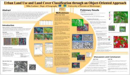
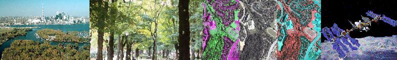
Masters Thesis Research "An Object-Oriented Approach to Urban Land-Cover and Land-Use Classification" |
||
|
For my Masters thesis project, I examined the use of high-resolution
satellite imagery and ancillary data for creating detailed land-cover and
land-use maps. I primarily worked with eCognition software for all
classifications and also used ArcGIS and Erdas Imagine for some analytical, image
pre-processing, and cartographic tasks. The most accurate land-cover map built the base for the land-use map. Through examination of how the different land-cover classes relate to one another spatially, 10 land-use classes were distinguished. For example, large buildings surrounded by parking lots and little vegetation along a major street indicated a industrial or commercial land use. In similar fashion, all other land-use classes were extracted. |
Thesis excerpts (links open pdf files)
Presentation of preliminary results
at the AAG Annual Conference
(Chicago, March 2006)
|
||
|
Undergraduate Research |
|||
|
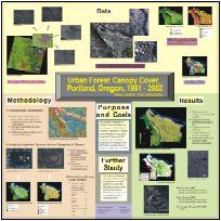
1) Brief project
description: Canopy cover was also related to different land-use classes in order to derive recommendations for canopy-cover targets for the respective land-use classes. More information about this
project can be found on the website The project also led to
several presentations, including a poster presentation (The poster was awarded "Best Student Entry" among all student
posters.) at the "GIS
in Action" conference.
|
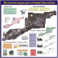
2) Brief project description: The final report "2002 Urban Forest Canopy & Land Use in Portland's Hollywood District" includes more detail about this project.
Results were also presented in poster format at the
|
||
|
Miscellaneous Projects (Selection of coursework and other projects) |
|||
|
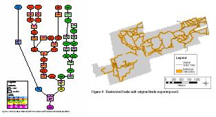
Term project for GGR 1907 (Advanced GIS - UofT) The project explored determining random sample points for different clusters of an unsupervised classification and then connect them through a cost surface in the most time-efficient way possible. The modeling approach described in the project report can be used to efficiently plan sample-site visits during field research.
|
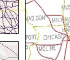
Mapping historic US travel routes (UofT) As part of some contract work, I used the ArcScan extension in ArcMap to semi-automatically digitize line features from scanned paper maps that also had to be georeferenced to modern-day US boundaries. The ArcMap screenshot shows small zoomed-in portions of the final maps, which are part of ongoing research and are not yet published.
|
||
|
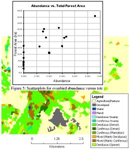
Term project for GGR 1304 (Landscape Biogeography - UofT) In this project, several landscape metrics were evaluated by exploring ovenbird habitat in Southern Ontario. Correlation of ovenbird abundance and 19 different landscape metrics and variables revealed that certain metrics are better indicators for ovenbird breading habitat than others.
|
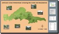
Poster Project (GIS Capstone course - PSU) As part of my capstone course in the final year of my undergraduate studies, I was responsible for creating a map of the Johnson Creek watershed in Portland, OR. The map shows point locations of streets crossing Johnson Creek and major arterials crossing the creek, among other features.
|
||